Coahuila, formally Coahuila de Zaragoza, officially Estado Libre y Soberano de Coahuila de Zaragoza (Free and Sovereign State of Coahuila de Zaragoza) is one of the 31 states which, with the Federal District, comprise the 32 federal Entities of Mexico. The state is located in Northeastern.
Coahuila borders the Mexican states of Nuevo Leon to the east, Zacatecas and San Luis Potosi to the south, and Durango and Chihuahua to the west. To the north, Coahuila accounts for a 512 kilometers (318 mi) stretch of the U.S. - Mexico border, adjacent to the United States state of Texas along the course of the Rio Grande (Rio Bravo). With an area of 151,563 square kilometers (58,518.8 sq mi), it is the nation's third-largest state. It comprises 38 municipalities. In 2010, Coahuila's population is 2,655,187 inhabitants.
The capital of Coahuila is Saltillo, and its largest city is Torreon. Coahuila also includes the cities of Monclova (a former state capital), Piedras Negras, and Ciudad Acuña.
Geography
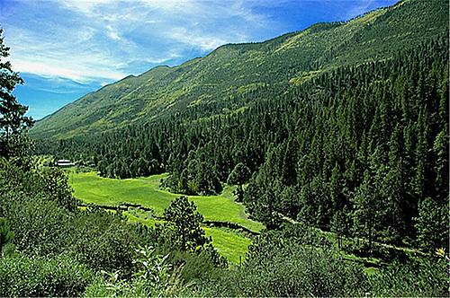
The Sierra Madre Oriental runs northwest to southeast through the State, and the higher elevations are home to the Sierra Madre Oriental pine-oak forests.
East of the range, the land slopes gently toward the Rio Grande, and is drained by several rivers, including the Salado and its tributary the Sabinas. The Tamaulipan mezquital, a dry shrubland ecoregion, occupies the eastern portion of the State, and extends across the Rio Grande into southern Texas.
The portion of the State west of the Sierra Madre Oriental lies on the Mexican Plateau, and is part of the Chihuahuan Desert. The Bolsón de Mapimí is a large endorheic basin which covers much of the western portion of the State and extends into adjacent portions of Chihuahua, Durango, and Zacatecas. The Nazas River, which flows east from Durango, and the Aguanaval River, which flows north from Zacatecas, empty into lakes in the Bolsón. Torreón, the most populous city in the State, lies on the Nazas in the irrigated Laguna Region, the (Comarca Lagunera), which straddles the border of Coahuila and Durango.
Coahuila contains two biosphere reserves. Maderas del Carmen lies on the northern border of the State, and includes sections of the Chihuahuan desert and sky islands of pine-oak forest in the Sierra del Carmen. The springs, lakes, and wetlands of Cuatro Ciénegas lie west of Monclova on the west slope of the Sierra Madre.
Cuatrocienegas
Las playitas- Cuatrocienegas
(oasis in the desert)
Desert of Cuatrocienegas
Boquillas del Carmen- National Park
Coahuila is largely arid or semi-arid, but the rivers of the State support extensive irrigated agriculture, particularly cotton. The Parras district in the southern part of the State produces wines and brandies. The pine-oak forests of the Sierra Madre produce timber.
Monterreal- Arteaga mountains
Monterreal- Arteaga mountains
Parras Madero
Video of Coahuila


